HOW TO RESTORE A CREEK NEXT TO A RAMSAR WETLAND
Southland’s Waituna lagoon is set in 3500 hectares of natural beauty – teeming with wildlife, it’s a Ramsar Wetland of International Importance. It’s culturally significant to Ngai Tahu and a precious source of food and recreation for fishermen, hunters, and trampers.
It also has around 45 Fonterra dairy farms in its catchment
The challenge at Waituna lagoon is water quality. Sediment and nutrients flow into the lagoon from the surrounding land, because the natural filters like wetlands and streams have been highly modified.
If a healthier freshwater ecosystem were in place surrounding the lagoon, it could slow the water, decrease contaminants and build better habitat. In other words, we need to turn off the tap of contaminants running into the lagoon.
Where do you start? Through the Living Water partnership, the Department of Conservation and Fonterra are working with Fonterra farmers, scientists, councils, communities and Mana Whenua together to “find game-changing solutions that will enable farming, fresh water and healthy eco-systems to thrive side-by-side” – and one of the Southland projects is to restore Waituna Creek.
DOC ranger Jane Bowen, who has worked closely with Fonterra Sustainable Dairying Advisor Cain Duncan, fills us in on what’s happened so far:

Cain Duncan

Pat Hoffmann

The creek runs through an intensively farmed catchment, and its water quality is poor. There is a marginal strip and esplanade reserve next to the creek, but these boundaries have been difficult to formalise and have been fenced often at the very top of the creek bank. This means there is almost no buffer from stock, so sediment and nutrients run straight into the creek.
This year we kicked off a big project to restore the creek, with the first trials funded by the Fonterra-DOC partnership, Living Water.
These first projects aim to create better habitat for wildlife while reducing sediment and nutrients flowing through to Waituna Lagoon.
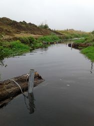
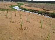
We did this by bank reprofiling (benching and two stage channelling), installing instream structures in the form of macrocarpa logs and bundles of manuka, and extensive riparian planting. We hope the instream structures will provide fish habitat/refuge while also varying the speed of the water, creating pools and riffles, and that the two-stage channelling combined with riparian planting will stabilise banks, cater for floods, slow the water in high flows and help reduce sediment and nutrients.
How did we do it? A lot of hard slog!
The bank reprofiling took place over three weeks in February 2018 and was considerably more work than first imagined!
Huge amounts of earth were moved over this time, and benches were formed in the creek banks to create the two-stage channel.
Waituna Creek Timelapse
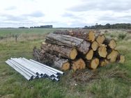
Next, the logs were anchored into place. Each log was approximately 3m long and was cabled to two steel poles anchored three metres into the creek bed. With downstream structures it was important to make sure they weren’t coming out! Logs were placed at a 30 degree angle to the creek bed pointing upstream and butted into the stream bank as much as possible.
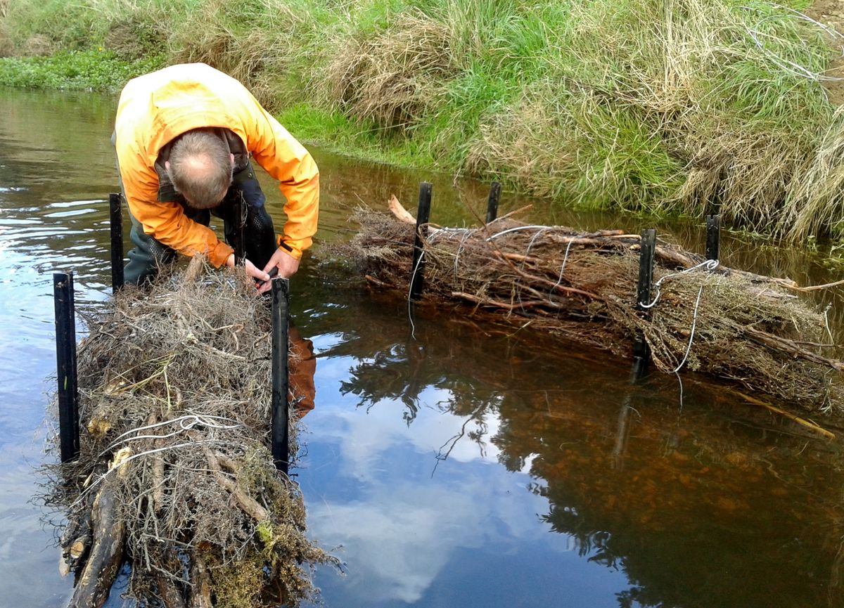
The manuka bundles were wired together and then anchored with warratahs into the creek bed mid-stream, some in a “V” formation to help create artificial riffles.


Race to the finish: With unforeseen poor weather coming our way it then became a race to get some sediment control in place given that the creek banks were now bare earth. We used a coir matting product to help with this and given the time constraints, we hired a forestry crew to install the matting and plant the creek banks. The efficiency of these crews is amazing- a great way to get a large area planted quickly!
What's next? Seeing how well it works
Our next steps are to monitor the performance of our structures. There have been some fairly high flows through Waituna Creek since installation and so far, everything is performing perfectly. Fish monitoring took place in March 2018. This year we need to get the marginal strip formalised and the fence moved to the correct place which will provide a much better buffer from neighbouring farming practices. Once the regional council is happy that our instream structures are not increasing erosion or flooding potential then we intend to double the amount of structures we have in the creek. Planting will continue on the marginal strip, and Phase 2 planning is set to take place shortly. Watch this space!
Many thanks to all who have been involved in this project- both Fonterra and Department of Conservation staff (past and present) have been integral to seeing this project through. An awesome example of a great partnership. The Department of Conservation national programme, Awarai Kakariki, has also had an integral part in funding and undertaking of the work which informed this project. A special thanks to Awarua runaka for partnering with us to lodge a joint resource consent, a huge show of support for the project!
